NASA Earth Science: Taking the Pulse of Our Home Planet
Dr. Dahlia Kirschbaum discusses how NASA uses Earth-observing satellites to understand everything from global rainfall to natural disasters like landslides and fires. With a background in geoscience and a passion for understanding natural disasters, Dr. Kirschbaum discusses how satellite data helps protect lives and property from hazards like landslides and floods.
[00:00:12] Dr. Dahlia Kirschbaum is a scientist at NASA Goddard Space Flight Center who turned a love of math and geosciences into a career studying natural disasters. One of her favorite experiences was standing in front of a fully assembled satellite designed to measure global rainfall and help save lives on Earth.
A System of Systems
[00:01:00] While many think of NASA only in terms of deep space exploration, the agency currently operates over two dozen satellites with their eyes pointed down at Earth. These satellites take the “pulse” of our planet by asking how the Earth system is changing, what causes those changes, and how they will affect society in the future.
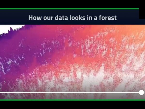
[00:01:31] We cannot look at Earth’s processes in isolation. Scientists use a “system of systems” approach to understand the relationships between different environments. For example, how do changes in sea surface temperatures affect global weather? How does vegetation on land influence soil quality and water bodies?
Measuring Rain, Snow, and Soil
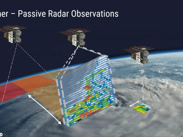
[00:02:02] A key mission in this effort is the Global Precipitation Measurement (GPM) mission. Launched in 2014 as an international partnership between NASA and Japan, GPM provides a global picture of how rain and snow move across the world—from storm systems in the Southern Ocean to atmospheric rivers impacting the West Coast of the U.S.
[00:03:06] Satellites also help us understand what happens after it rains. Missions like the Soil Moisture Active Passive (SMAP) mission allow us to see the soil getting wetter in real-time. This data is critical for predicting floods and understanding how the oceans and land interact.
Tracking Fires and Landslides
[00:04:02] NASA builds complex global models to visualize how particles move through our atmosphere. During the 2019 Australian bushfires, NASA models showed how smoke, carbon, and dust transported across the Southern Ocean to affect South America. Similarly, dust from the Sahara Desert can act as the “nuclei” for hurricanes that eventually impact the United States.
[00:04:52] Dr. Kirschbaum’s specific research focus is the modeling of landslides. By combining data on rainfall, steep topography, and changes in vegetation, NASA can identify landslide “hotspots” around the world to help populations prepare for these hazards.
Advice for Future Scientists
[00:05:36] Earth Science is a tremendous field with room for many different skill sets. As Dr. Kirschbaum notes, “You can do anything you want as long as you have a direction.” For students inspired by Earth observation, the best path is to take science, math, and engineering classes to figure out how you can help make the world a better place.
Home » Articles »